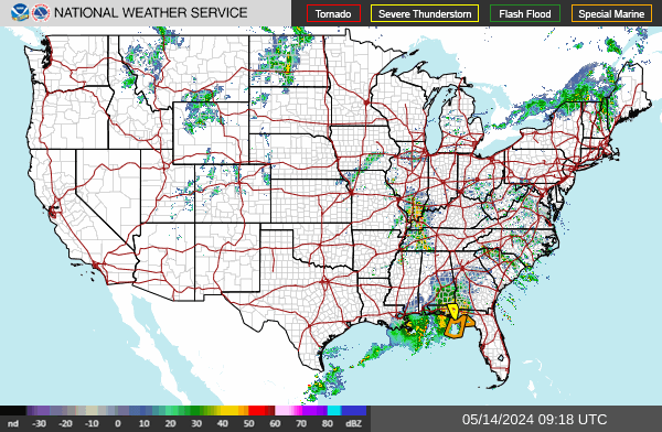
Lake Charles
KLCH
More Info
Type: WSR-88D
ID: KLCH
Lat: 30.1253
Long: -93.21588

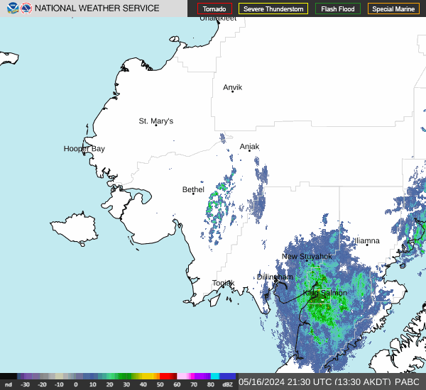
Bethel
PABC
More Info
Type: WSR-88D
ID: PABC
Lat: 60.79194
Long: -161.87637
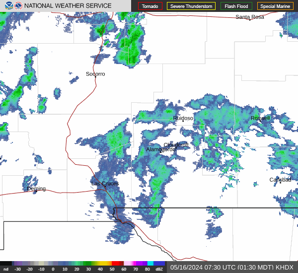
El Paso
KEPZ
More Info
Type: WSR-88D
ID: KEPZ
Lat: 31.87305
Long: -106.69799

Cheyenne
KCYS
More Info
Type: WSR-88D
ID: KCYS
Lat: 41.15194
Long: -104.8061

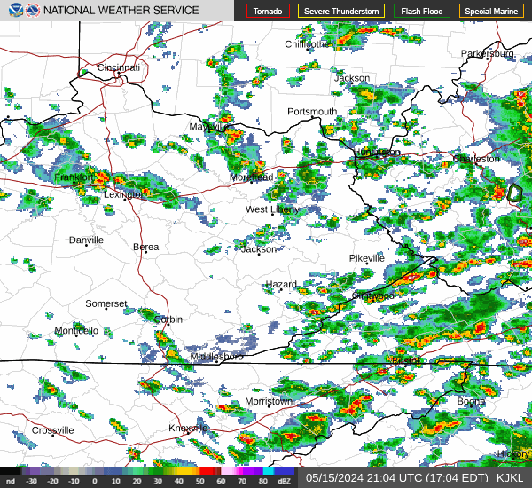
Jackson,KY
KJKL
More Info
Type: WSR-88D
ID: KJKL
Lat: 37.59083
Long: -83.31305
Paducah
KPAH
More Info
Type: WSR-88D
ID: KPAH
Lat: 37.06833
Long: -88.77194

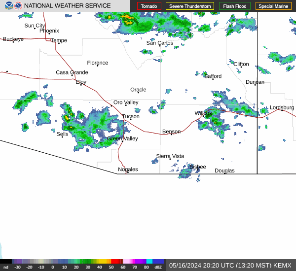
Tucson
KEMX
More Info
Type: WSR-88D
ID: KEMX
Lat: 31.89361
Long: -110.63027
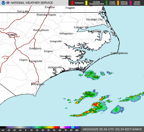
Morehead City
KMHX
More Info
Type: WSR-88D
ID: KMHX
Lat: 34.77583
Long: -76.87639
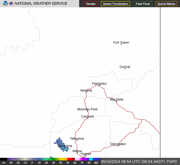
Fairbanks Faa
PAPD
More Info
Type: WSR-88D
ID: PAPD
Lat: 65.03511
Long: -147.5014
Duluth
KDLH
More Info
Type: WSR-88D
ID: KDLH
Lat: 46.83694
Long: -92.20971

Brookhaven
KOKX
More Info
Type: WSR-88D
ID: KOKX
Lat: 40.86552
Long: -72.86392

Little Rock
KLZK
More Info
Type: WSR-88D
ID: KLZK
Lat: 34.83638
Long: -92.26194

Houston
KHGX
More Info
Type: WSR-88D
ID: KHGX
Lat: 29.47194
Long: -95.07888

Jackson/Brandon,MS
KDGX
More Info
Type: WSR-88D
ID: KDGX
Lat: 32.27999
Long: -89.98444

Amarillo
KAMA
More Info
Type: WSR-88D
ID: KAMA
Lat: 35.23333
Long: -101.70927

Andersen AFB
PGUA
More Info
Type: WSR-88D
ID: PGUA
Lat: 13.45583
Long: 144.81112
NCL Michigan
KAPX
More Info
Type: WSR-88D
ID: KAPX
Lat: 44.90634
Long: -84.71953

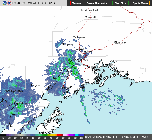
Kenai
PAHG
More Info
Type: WSR-88D
ID: PAHG
Lat: 60.72591
Long: -151.35144
Sterling
KLWX
More Info
Type: WSR-88D
ID: KLWX
Lat: 38.9761
Long: -77.4875

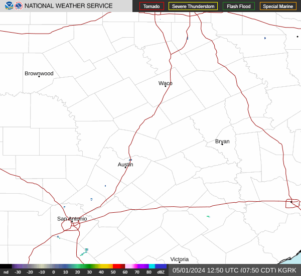
Ft Hood
KGRK
More Info
Type: WSR-88D
ID: KGRK
Lat: 30.72166
Long: -97.38277
Norfolk
KAKQ
More Info
Type: WSR-88D
ID: KAKQ
Lat: 36.98388
Long: -77.0075

Charleston,SC
KCLX
More Info
Type: WSR-88D
ID: KCLX
Lat: 32.65552
Long: -81.04219

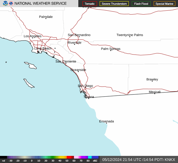
San Diego
KNKX
More Info
Type: WSR-88D
ID: KNKX
Lat: 32.91888
Long: -117.04193
Buffalo
KBUF
More Info
Type: WSR-88D
ID: KBUF
Lat: 42.9486
Long: -78.73694

Norman
KTLX
More Info
Type: WSR-88D
ID: KTLX
Lat: 35.33305
Long: -97.27775

Lincoln
KILX
More Info
Type: WSR-88D
ID: KILX
Lat: 40.15049
Long: -89.33679

Hammond
KHDC
More Info
Type: WSR-88D
ID: KHDC
Lat: 30.5196
Long: -90.4074

Evansville,IN
KVWX
More Info
Type: WSR-88D
ID: KVWX
Lat: 38.26024
Long: -87.72452

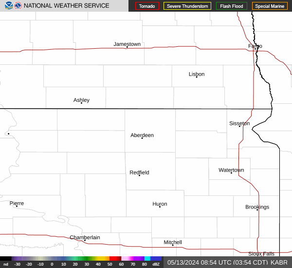
Sioux Falls
KFSD
More Info
Type: WSR-88D
ID: KFSD
Lat: 43.58777
Long: -96.72888

Pleasant Hill
KEAX
More Info
Type: WSR-88D
ID: KEAX
Lat: 38.81024
Long: -94.26446

Cedar City
KICX
More Info
Type: WSR-88D
ID: KICX
Lat: 37.59104
Long: -112.86221

Northeast Alabama
KHTX
More Info
Type: WSR-88D
ID: KHTX
Lat: 34.93055
Long: -86.08361

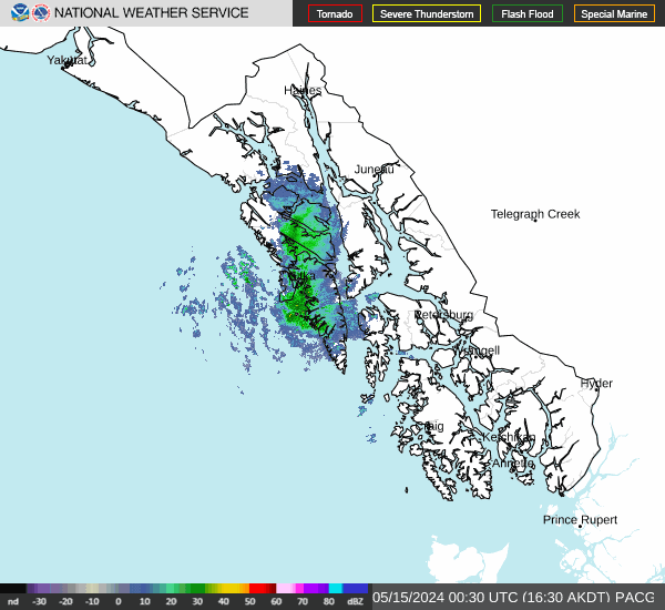
Sitka
PACG
More Info
Type: WSR-88D
ID: PACG
Lat: 56.85277
Long: -135.52915
Santa Ana Mts
KSOX
More Info
Type: WSR-88D
ID: KSOX
Lat: 33.81773
Long: -117.63599

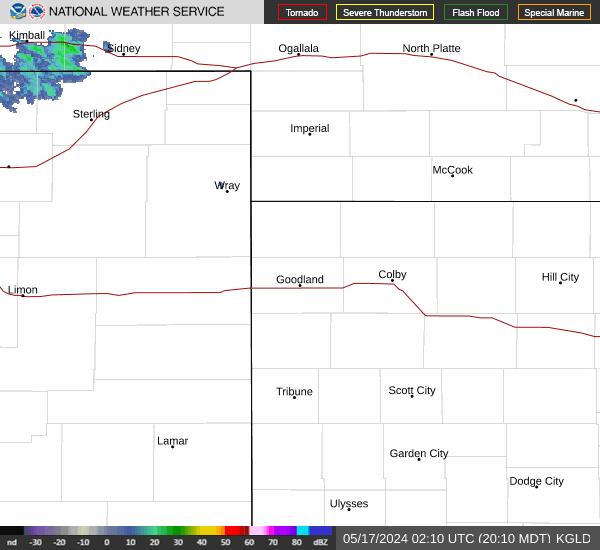
Goodland
KGLD
More Info
Type: WSR-88D
ID: KGLD
Lat: 39.36694
Long: -101.70027
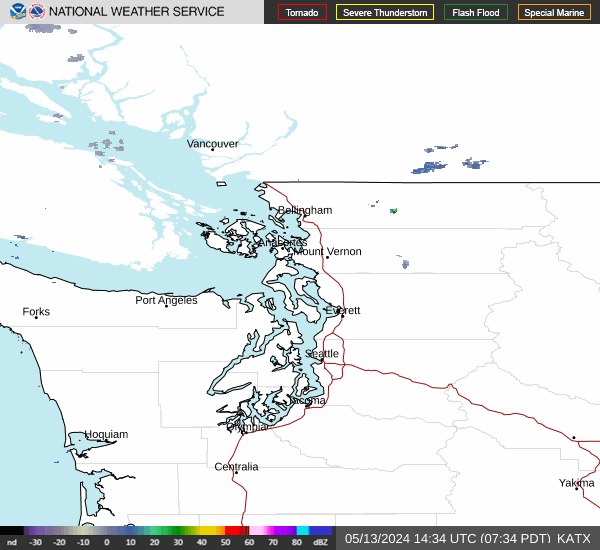
Seattle
KATX
More Info
Type: WSR-88D
ID: KATX
Lat: 48.19461
Long: -122.49568
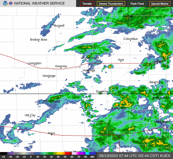
Grand Island
KUEX
More Info
Type: WSR-88D
ID: KUEX
Lat: 40.32083
Long: -98.44194
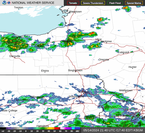
Binghamton
KBGM
More Info
Type: WSR-88D
ID: KBGM
Lat: 42.19969
Long: -75.98472
Columbia
KCAE
More Info
Type: WSR-88D
ID: KCAE
Lat: 33.9486
Long: -81.11861

Quad Cities
KDVN
More Info
Type: WSR-88D
ID: KDVN
Lat: 41.61166
Long: -90.58083

Aberdeen
KABR
More Info
Type: WSR-88D
ID: KABR
Lat: 45.45583
Long: -98.41305
Key West
KBYX
More Info
Type: WSR-88D
ID: KBYX
Lat: 24.59694
Long: -81.70333

Minneapolis
KMPX
More Info
Type: WSR-88D
ID: KMPX
Lat: 44.84888
Long: -93.56552

Corpus Christi
KCRP
More Info
Type: WSR-88D
ID: KCRP
Lat: 27.78388
Long: -97.51083

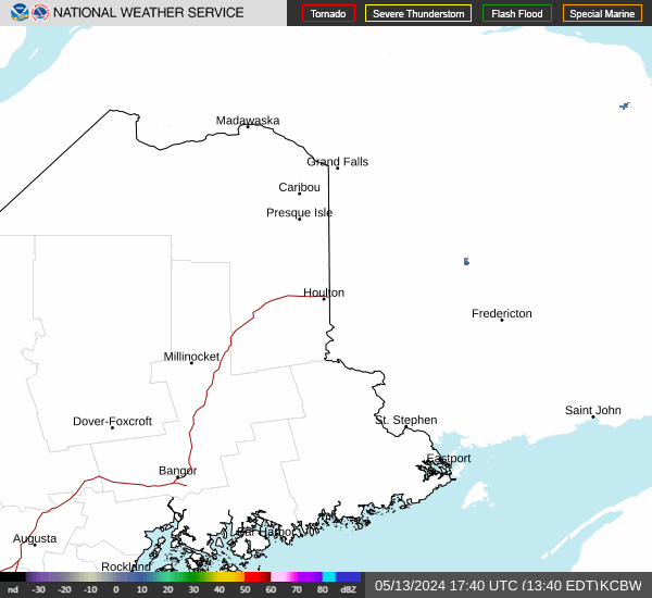
Caribou
KCBW
More Info
Type: WSR-88D
ID: KCBW
Lat: 46.03916
Long: -67.80642
Knoxville
KMRX
More Info
Type: WSR-88D
ID: KMRX
Lat: 36.16833
Long: -83.40194

Shreveport
KSHV
More Info
Type: WSR-88D
ID: KSHV
Lat: 32.45083
Long: -93.84124

Phoenix
KIWA
More Info
Type: WSR-88D
ID: KIWA
Lat: 33.28916
Long: -111.66999

Reno
KRGX
More Info
Type: WSR-88D
ID: KRGX
Lat: 39.75405
Long: -119.46202

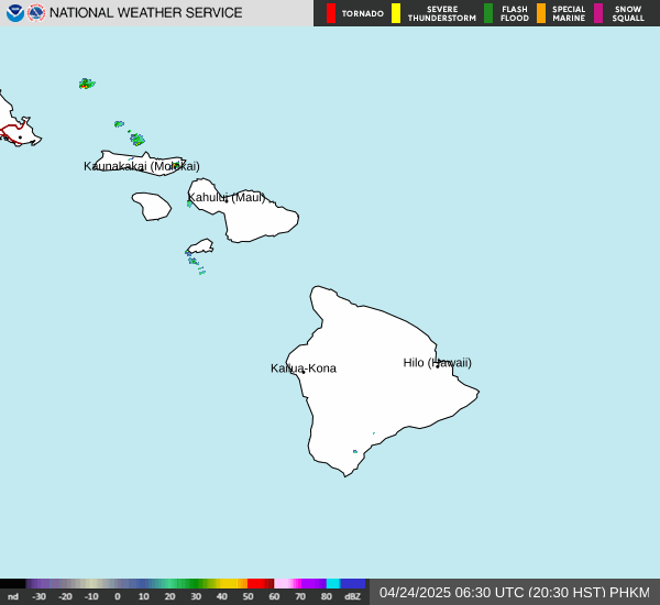
Kamuela/Kohala Apt
PHKM
More Info
Type: WSR-88D
ID: PHKM
Lat: 20.12527
Long: -155.77776
Albuquerque
KABX
More Info
Type: WSR-88D
ID: KABX
Lat: 35.14972
Long: -106.82388

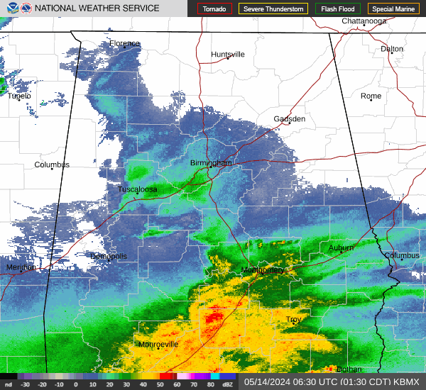
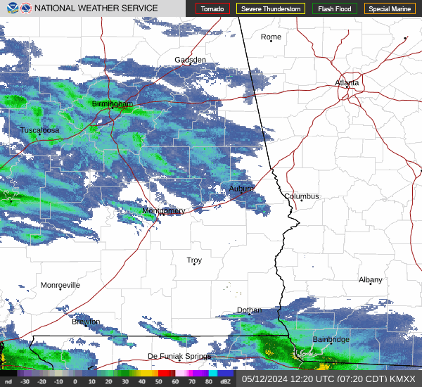
Birmingham
KBMX
More Info
Type: WSR-88D
ID: KBMX
Lat: 33.17194
Long: -86.76972
Moody AFB
KVAX
More Info
Type: WSR-88D
ID: KVAX
Lat: 30.89027
Long: -83.0018

Holloman AFB
KHDX
More Info
Type: WSR-88D
ID: KHDX
Lat: 33.07699
Long: -106.12002
Brownsville
KBRO
More Info
Type: WSR-88D
ID: KBRO
Lat: 25.91555
Long: -97.4186

Topeka
KTWX
More Info
Type: WSR-88D
ID: KTWX
Lat: 38.99694
Long: -96.23249
Portland,OR
KRTX
More Info
Type: WSR-88D
ID: KRTX
Lat: 45.71499
Long: -122.96499

Burlington
KCXX
More Info
Type: WSR-88D
ID: KCXX
Lat: 44.5111
Long: -73.16639
Roanoke
KFCX
More Info
Type: WSR-88D
ID: KFCX
Lat: 37.02416
Long: -80.27416

Atlanta
KFFC
More Info
Type: WSR-88D
ID: KFFC
Lat: 33.36333
Long: -84.56583

Boston
KBOX
More Info
Type: WSR-88D
ID: KBOX
Lat: 41.95577
Long: -71.13686

Tallahassee
KTLH
More Info
Type: WSR-88D
ID: KTLH
Lat: 30.39749
Long: -84.32889

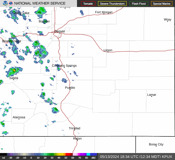
Pueblo
KPUX
More Info
Type: WSR-88D
ID: KPUX
Lat: 38.45944
Long: -104.18138
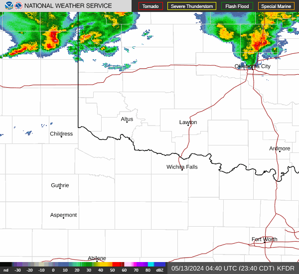
Altus AFB
KFDR
More Info
Type: WSR-88D
ID: KFDR
Lat: 34.36219
Long: -98.97666
Grand Junction
KGJX
More Info
Type: WSR-88D
ID: KGJX
Lat: 39.06222
Long: -108.21375

Detroit
KDTX
More Info
Type: WSR-88D
ID: KDTX
Lat: 42.69999
Long: -83.47166

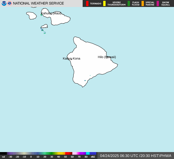
South Shore
PHWA
More Info
Type: WSR-88D
ID: PHWA
Lat: 19.095
Long: -155.56887
Marquette
KMQT
More Info
Type: WSR-88D
ID: KMQT
Lat: 46.5311
Long: -87.54833

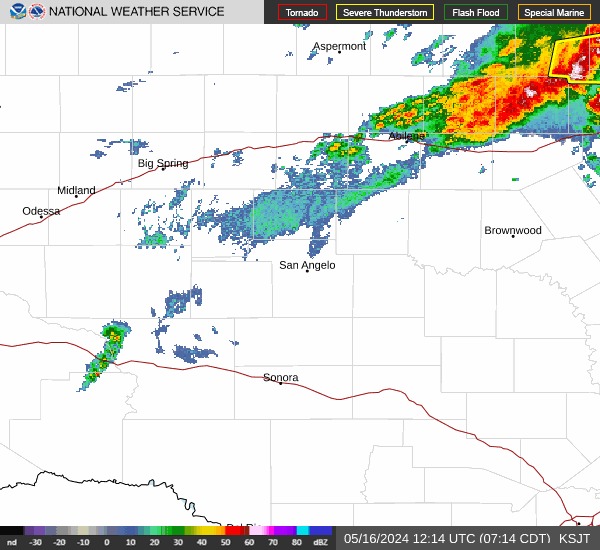
San Angelo
KSJT
More Info
Type: WSR-88D
ID: KSJT
Lat: 31.37111
Long: -100.49221
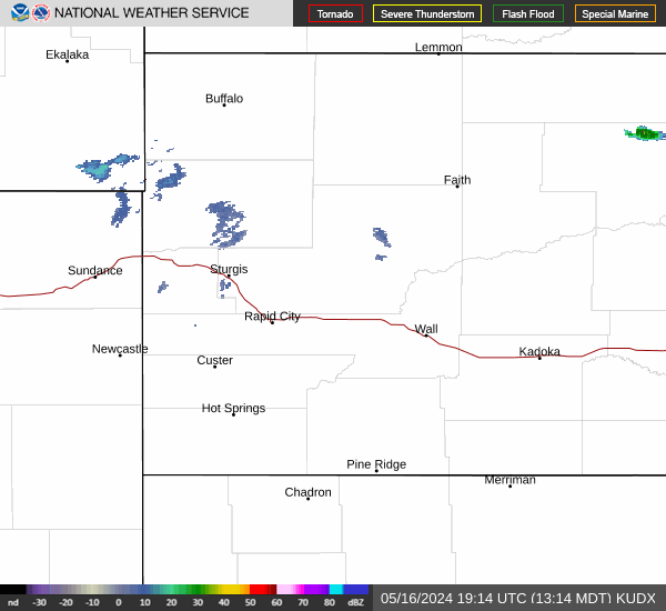
Rapid City
KUDX
More Info
Type: WSR-88D
ID: KUDX
Lat: 44.12471
Long: -102.82999
Western Arkansas
KSRX
More Info
Type: WSR-88D
ID: KSRX
Lat: 35.29041
Long: -94.36188

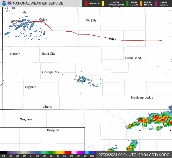
Dodge City
KDDC
More Info
Type: WSR-88D
ID: KDDC
Lat: 37.76083
Long: -99.96888
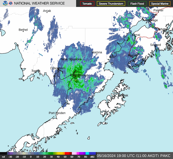
King Salmon
PAKC
More Info
Type: WSR-88D
ID: PAKC
Lat: 58.67944
Long: -156.62942
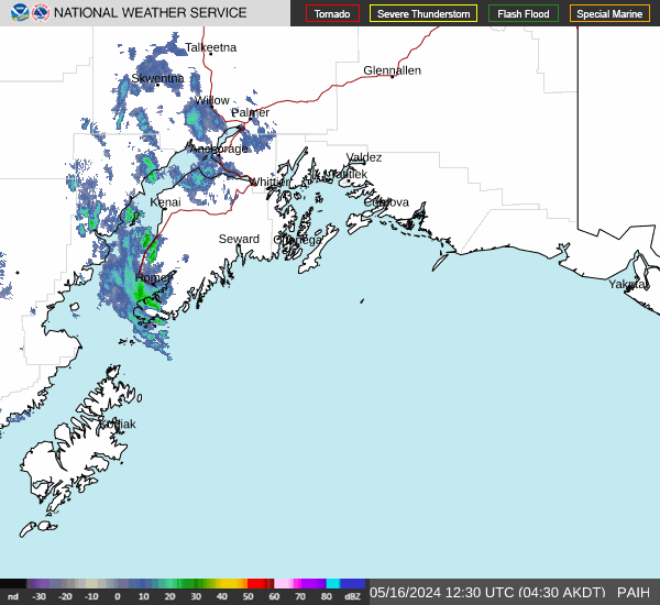
Middleton Island
PAIH
More Info
Type: WSR-88D
ID: PAIH
Lat: 59.46194
Long: -146.30109
Kadena AB
RODN
More Info
Type: WSR-88D
ID: RODN
Lat: 26.30194
Long: 127.90972

Northern Indiana
KIWX
More Info
Type: WSR-88D
ID: KIWX
Lat: 41.3586
Long: -85.7
Cannon AFB
KFDX
More Info
Type: WSR-88D
ID: KFDX
Lat: 34.63416
Long: -103.61888

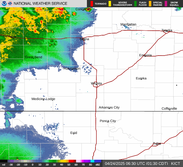
Wichita
KICT
More Info
Type: WSR-88D
ID: KICT
Lat: 37.65444
Long: -97.44305
La Crosse
KARX
More Info
Type: WSR-88D
ID: KARX
Lat: 43.82277
Long: -91.1911

Elko
KLRX
More Info
Type: WSR-88D
ID: KLRX
Lat: 40.73972
Long: -116.80277

Sacramento
KDAX
More Info
Type: WSR-88D
ID: KDAX
Lat: 38.50111
Long: -121.67782

Green Bay
KGRB
More Info
Type: WSR-88D
ID: KGRB
Lat: 44.49862
Long: -88.1111

Langley Hill
KLGX
More Info
Type: WSR-88D
ID: KLGX
Lat: 47.11689
Long: -124.10663

Denver
KFTG
More Info
Type: WSR-88D
ID: KFTG
Lat: 39.78663
Long: -104.5458

Milwaukee
KMKX
More Info
Type: WSR-88D
ID: KMKX
Lat: 42.96777
Long: -88.55055

Laughlin AFB
KDFX
More Info
Type: WSR-88D
ID: KDFX
Lat: 29.2725
Long: -100.28027

Pocatello
KSFX
More Info
Type: WSR-88D
ID: KSFX
Lat: 43.10559
Long: -112.68612

Salt Lake City
KMTX
More Info
Type: WSR-88D
ID: KMTX
Lat: 41.26277
Long: -112.44777

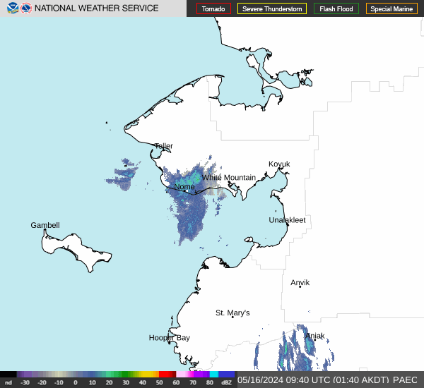
Nome
PAEC
More Info
Type: WSR-88D
ID: PAEC
Lat: 64.51139
Long: -165.29498
Camp Humphreys
RKSG
More Info
Type: WSR-88D
ID: RKSG
Lat: 37.20757
Long: 127.28556

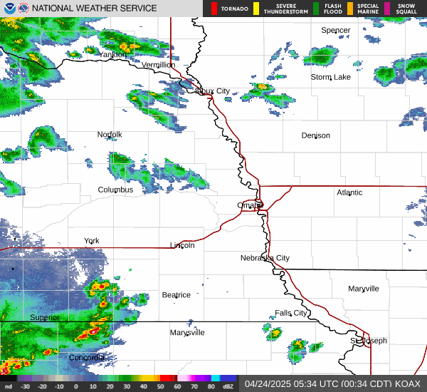
Omaha
KOAX
More Info
Type: WSR-88D
ID: KOAX
Lat: 41.32027
Long: -96.3668
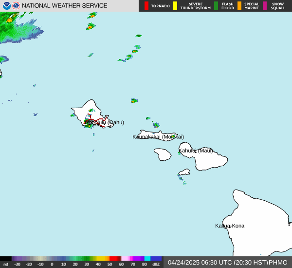
Molokai
PHMO
More Info
Type: WSR-88D
ID: PHMO
Lat: 21.13277
Long: -157.18026
Ft Drum
KTYX
More Info
Type: WSR-88D
ID: KTYX
Lat: 43.75582
Long: -75.68

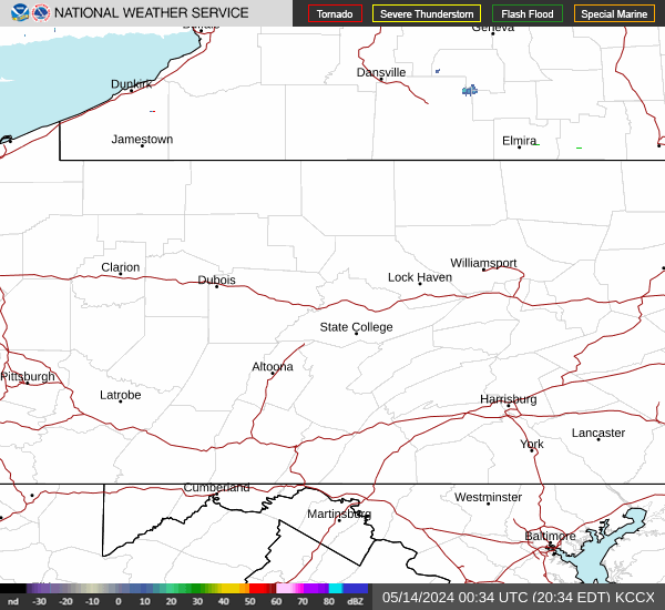
State College
KCCX
More Info
Type: WSR-88D
ID: KCCX
Lat: 40.92305
Long: -78.00389
Fargo/Grand Forks
KMVX
More Info
Type: WSR-88D
ID: KMVX
Lat: 47.52805
Long: -97.32499

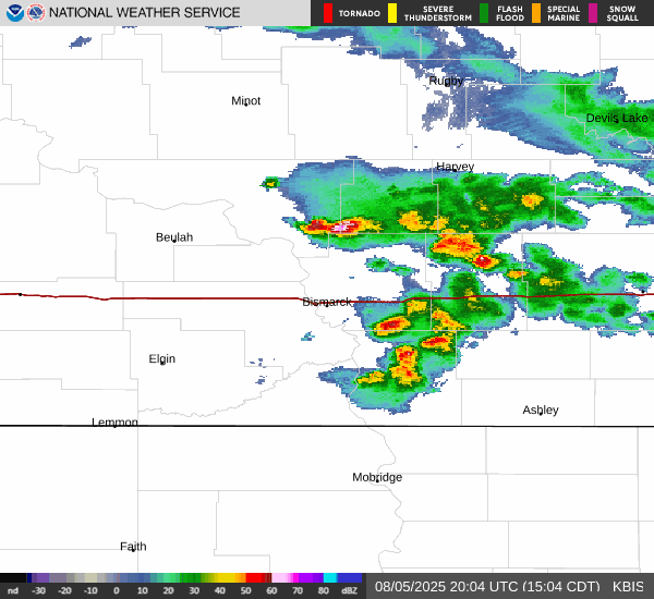
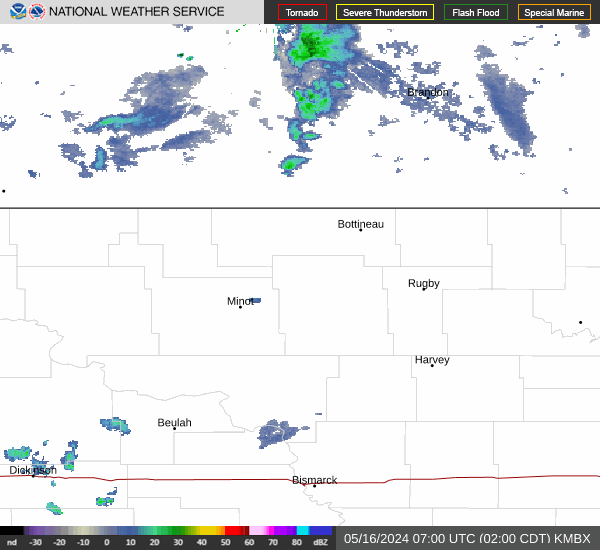
Bismarck
KBIS
More Info
Type: WSR-88D
ID: KBIS
Lat: 46.77083
Long: -100.76027
Beale AFB
KBBX
More Info
Type: WSR-88D
ID: KBBX
Lat: 39.49611
Long: -121.63165

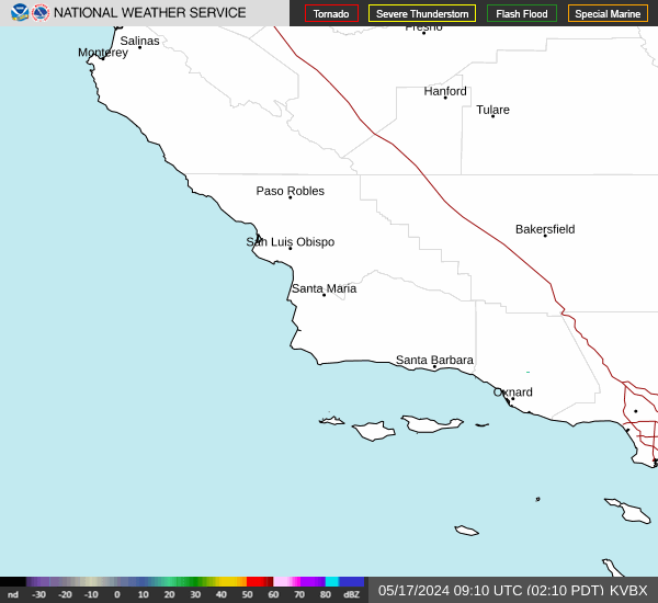
Vandenberg AFB
KVBX
More Info
Type: WSR-88D
ID: KVBX
Lat: 34.83855
Long: -120.3979
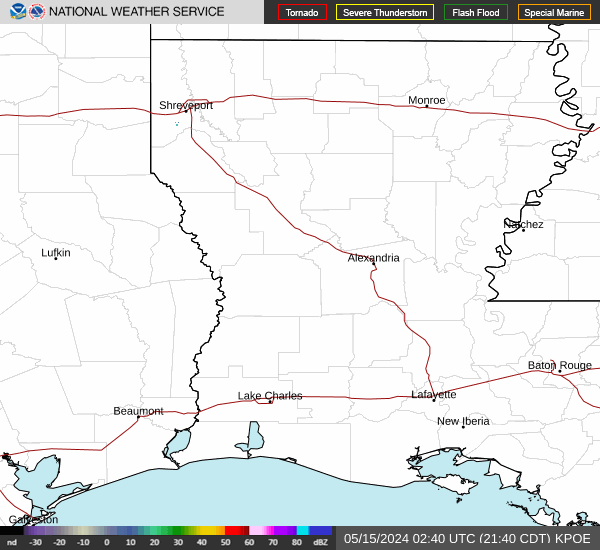
Ft Polk
KPOE
More Info
Type: WSR-88D
ID: KPOE
Lat: 31.15527
Long: -92.97583
Mobile
KMOB
More Info
Type: WSR-88D
ID: KMOB
Lat: 30.67944
Long: -88.23972

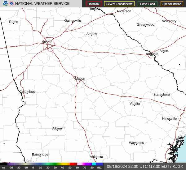
Robins AFB
KJGX
More Info
Type: WSR-88D
ID: KJGX
Lat: 32.67499
Long: -83.35111
San Francisco
KMUX
More Info
Type: WSR-88D
ID: KMUX
Lat: 37.15522
Long: -121.89843

St Louis
KLSX
More Info
Type: WSR-88D
ID: KLSX
Lat: 38.69888
Long: -90.68277

Medford
KMAX
More Info
Type: WSR-88D
ID: KMAX
Lat: 42.08111
Long: -122.71735

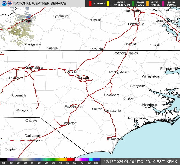
Raleigh/Durham
KRAX
More Info
Type: WSR-88D
ID: KRAX
Lat: 35.66527
Long: -78.49
Tulsa
KINX
More Info
Type: WSR-88D
ID: KINX
Lat: 36.17499
Long: -95.56413

Kunsan AB
RKJK
More Info
Type: WSR-88D
ID: RKJK
Lat: 35.92417
Long: 126.62222

Springfield
KSGF
More Info
Type: WSR-88D
ID: KSGF
Lat: 37.23527
Long: -93.40027

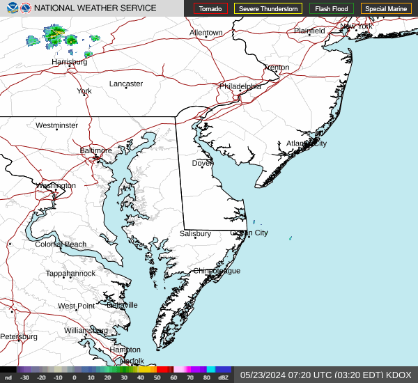
Dover AFB
KDOX
More Info
Type: WSR-88D
ID: KDOX
Lat: 38.82555
Long: -75.44
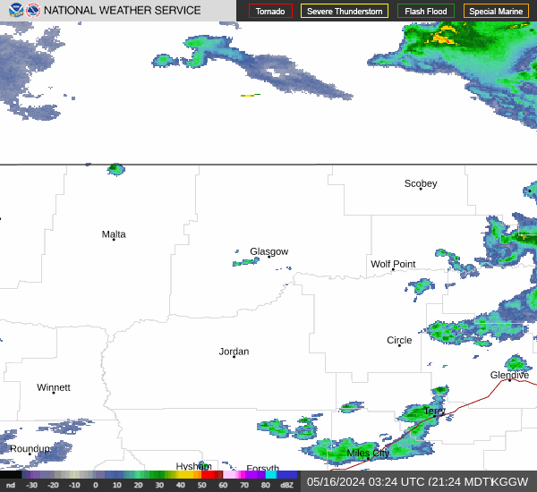
Glasgow
KGGW
More Info
Type: WSR-88D
ID: KGGW
Lat: 48.20635
Long: -106.62468
Miami
KAMX
More Info
Type: WSR-88D
ID: KAMX
Lat: 25.61055
Long: -80.41305

Albany
KENX
More Info
Type: WSR-88D
ID: KENX
Lat: 42.58655
Long: -74.06408

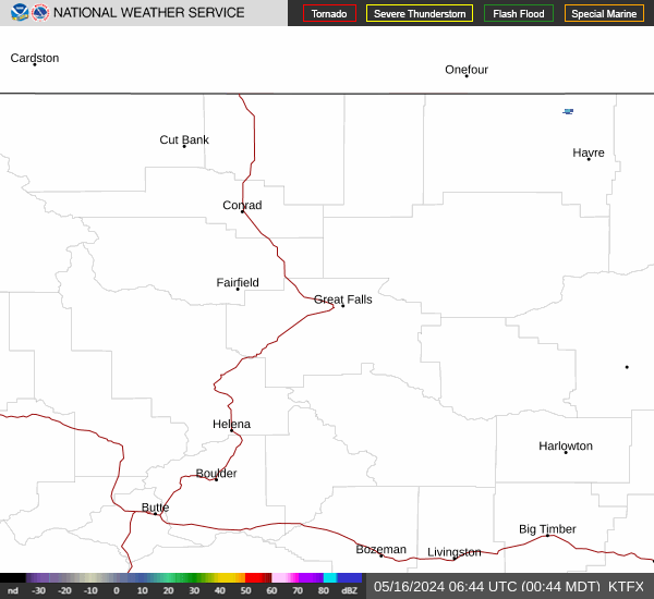
Great Falls
KTFX
More Info
Type: WSR-88D
ID: KTFX
Lat: 47.45972
Long: -111.38527
Pittsburgh
KPBZ
More Info
Type: WSR-88D
ID: KPBZ
Lat: 40.53166
Long: -80.21794

Midland/Odessa
KMAF
More Info
Type: WSR-88D
ID: KMAF
Lat: 31.94346
Long: -102.18924

Pendleton
KPDT
More Info
Type: WSR-88D
ID: KPDT
Lat: 45.69055
Long: -118.8529

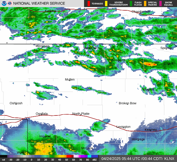
North Platte
KLNX
More Info
Type: WSR-88D
ID: KLNX
Lat: 41.95794
Long: -100.57621
Ft Rucker
KEOX
More Info
Type: WSR-88D
ID: KEOX
Lat: 31.46055
Long: -85.45938
Greer
KGSP
More Info
Type: WSR-88D
ID: KGSP
Lat: 34.8833
Long: -82.21983

Ft Campbell
KHPX
More Info
Type: WSR-88D
ID: KHPX
Lat: 36.73666
Long: -87.28499
Grand Rapids
KGRR
More Info
Type: WSR-88D
ID: KGRR
Lat: 42.89388
Long: -85.54488

Chicago
KLOT
More Info
Type: WSR-88D
ID: KLOT
Lat: 41.60444
Long: -88.08444

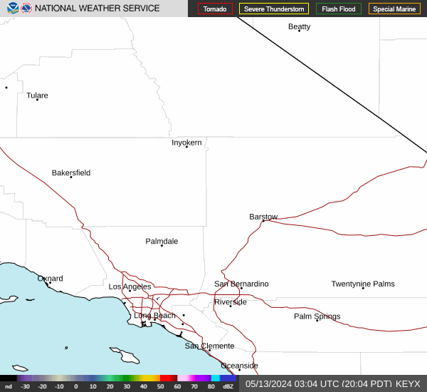
Edwards AFB
KEYX
More Info
Type: WSR-88D
ID: KEYX
Lat: 35.09777
Long: -117.56074
Dallas/Ft Worth
KFWS
More Info
Type: WSR-88D
ID: KFWS
Lat: 32.57277
Long: -97.30313

Melbourne
KMLB
More Info
Type: WSR-88D
ID: KMLB
Lat: 28.11305
Long: -80.65444

Minot AFB
KMBX
More Info
Type: WSR-88D
ID: KMBX
Lat: 48.39249
Long: -100.86443
Des Moines
KDMX
More Info
Type: WSR-88D
ID: KDMX
Lat: 41.7311
Long: -93.72285

Eglin Afb
KEVX
More Info
Type: WSR-88D
ID: KEVX
Lat: 30.56503
Long: -85.92166

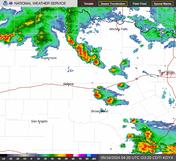
Dyess AFB
KDYX
More Info
Type: WSR-88D
ID: KDYX
Lat: 32.53833
Long: -99.25416
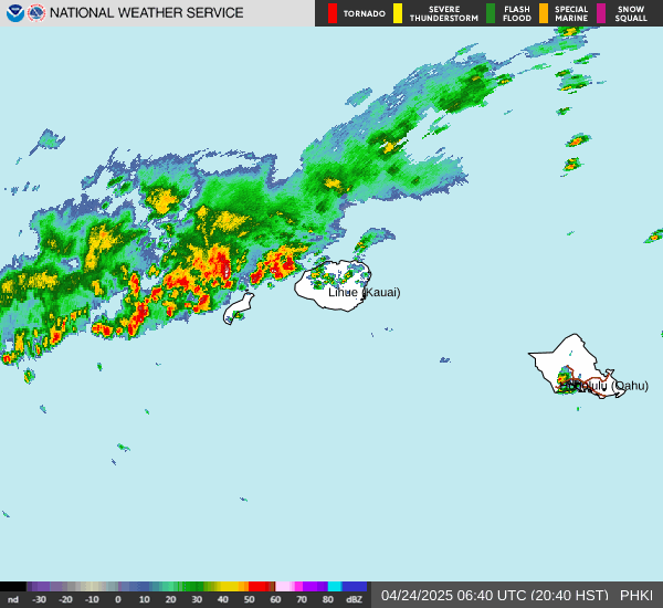
South Kauai
PHKI
More Info
Type: WSR-88D
ID: PHKI
Lat: 21.89389
Long: -159.55249
Philadelphia
KDIX
More Info
Type: WSR-88D
ID: KDIX
Lat: 39.94694
Long: -74.41072

Yuma
KYUX
More Info
Type: WSR-88D
ID: KYUX
Lat: 32.49527
Long: -114.65668

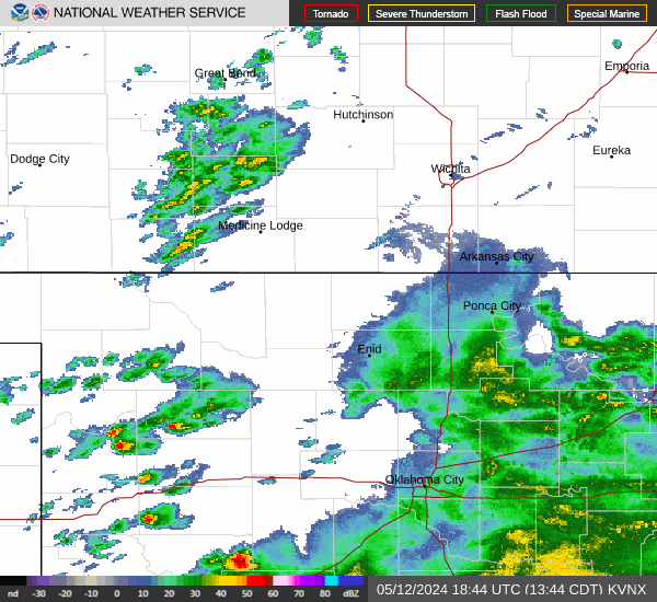
Vance AFB
KVNX
More Info
Type: WSR-88D
ID: KVNX
Lat: 36.74083
Long: -98.12749
San Juan
TJUA
More Info
Type: WSR-88D
ID: TJUA
Lat: 18.11566
Long: -66.07817

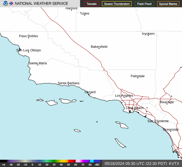
Los Angeles
KVTX
More Info
Type: WSR-88D
ID: KVTX
Lat: 34.41166
Long: -119.1786
Indianapolis
KIND
More Info
Type: WSR-88D
ID: KIND
Lat: 39.70749
Long: -86.28027

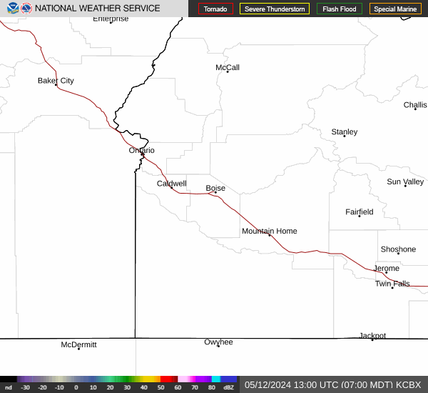
Boise
KCBX
More Info
Type: WSR-88D
ID: KCBX
Lat: 43.49021
Long: -116.23602
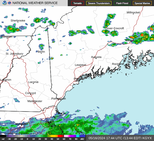
Portland,ME
KGYX
More Info
Type: WSR-88D
ID: KGYX
Lat: 43.8913
Long: -70.25636
Maxwell AFB
KMXX
More Info
Type: WSR-88D
ID: KMXX
Lat: 32.53664
Long: -85.78975
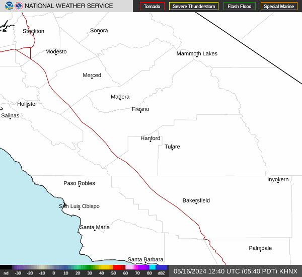
San Joaquin Valley
KHNX
More Info
Type: WSR-88D
ID: KHNX
Lat: 36.31416
Long: -119.63213
Louisville
KLVX
More Info
Type: WSR-88D
ID: KLVX
Lat: 37.97527
Long: -85.94388

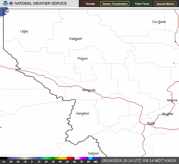
Missoula
KMSX
More Info
Type: WSR-88D
ID: KMSX
Lat: 47.0411
Long: -113.9861
Jacksonville
KJAX
More Info
Type: WSR-88D
ID: KJAX
Lat: 30.48463
Long: -81.7019

Memphis
KNQA
More Info
Type: WSR-88D
ID: KNQA
Lat: 35.34472
Long: -89.87333

Riverton/Lander
KRIW
More Info
Type: WSR-88D
ID: KRIW
Lat: 43.0661
Long: -108.47729

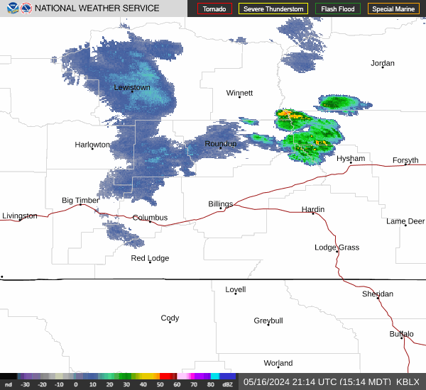
Billings
KBLX
More Info
Type: WSR-88D
ID: KBLX
Lat: 45.85377
Long: -108.60679
Charleston,WV
KRLX
More Info
Type: WSR-88D
ID: KRLX
Lat: 38.3111
Long: -81.72277

Cleveland
KCLE
More Info
Type: WSR-88D
ID: KCLE
Lat: 41.41305
Long: -81.86

Eureka (Bunker Hill)
KBHX
More Info
Type: WSR-88D
ID: KBHX
Lat: 40.49833
Long: -124.29215

Lubbock
KLBB
More Info
Type: WSR-88D
ID: KLBB
Lat: 33.65413
Long: -101.81416

Spokane
KOTX
More Info
Type: WSR-88D
ID: KOTX
Lat: 47.68055
Long: -117.62582

Austin/San Antonio
KEWX
More Info
Type: WSR-88D
ID: KEWX
Lat: 29.70405
Long: -98.0286

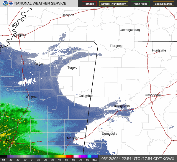
Columbus AFB
KGWX
More Info
Type: WSR-88D
ID: KGWX
Lat: 33.89691
Long: -88.32919
Las Vegas
KESX
More Info
Type: WSR-88D
ID: KESX
Lat: 35.70111
Long: -114.89138

Tampa
KTBW
More Info
Type: WSR-88D
ID: KTBW
Lat: 27.70527
Long: -82.40194

Nashville
KOHX
More Info
Type: WSR-88D
ID: KOHX
Lat: 36.24722
Long: -86.5625

Wilmington
KLTX
More Info
Type: WSR-88D
ID: KLTX
Lat: 33.98916
Long: -78.42916

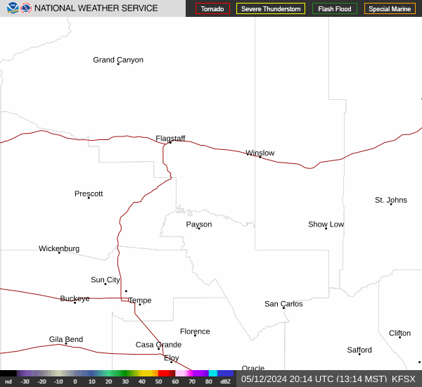
Flagstaff
KFSX
More Info
Type: WSR-88D
ID: KFSX
Lat: 34.57433
Long: -111.19843
Cincinnati
KILN
More Info
Type: WSR-88D
ID: KILN
Lat: 39.42027
Long: -83.82166